
Face Rock Heights is comprised of 229 acres, 171 owners (fall, 2020). Virtually all of the acreage is improved residential (31%) and unimproved residential (58%). Approximately 50% has been cleared of gorse as of Summer 2020, and approximately 25% remains gorse-filled.
UPDATE: virtually all of Face Rock Heights is cleared (of gorse) as of May, 2022.
pdf: “Memo to Oregon Solutions Donut Hole work group” regarding Land Use Context
Progress . . .
Prior to July, 2020, most of Face Rock Heights was impassable for decades. (Impassable area roughly included: Jackson along west side, Shamrock/Douglas along east side . . . 18th St SW along north side, 22nd St SW along south side).

Status for centuries:)
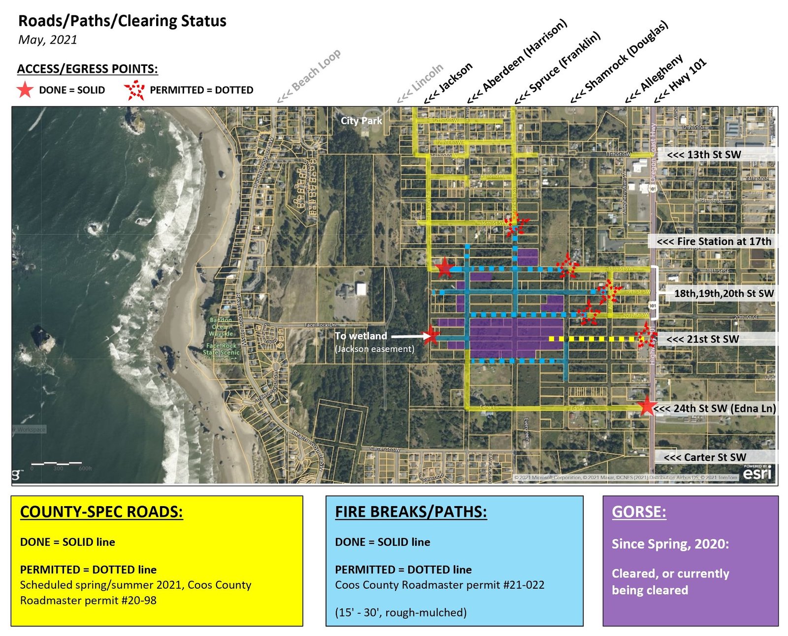
May 29, 2021
Snapshots of general Face Rock Heights information:

Statistics as of July, 2020 (ownership & status)

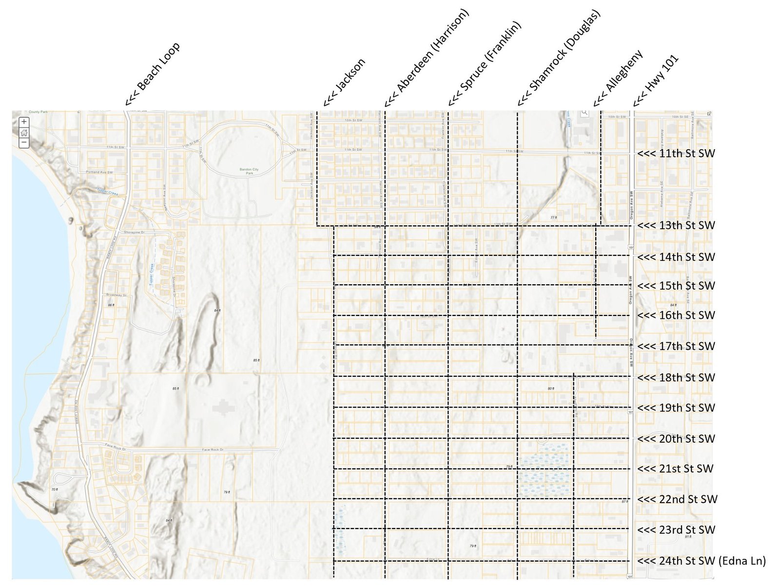
Boundary, aerial view

Donut hole according to CWSA, 2017 (includes parcels east of Hwy 101)
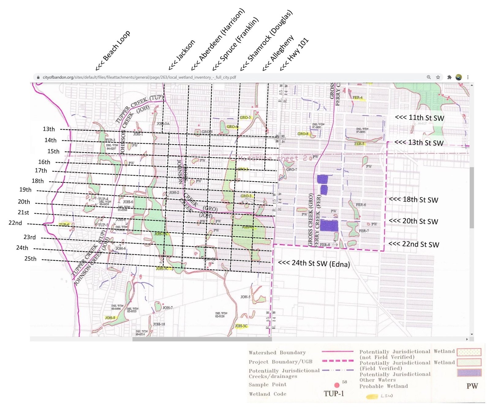
Wetlands – City of Bandon

Wetlands – NWI
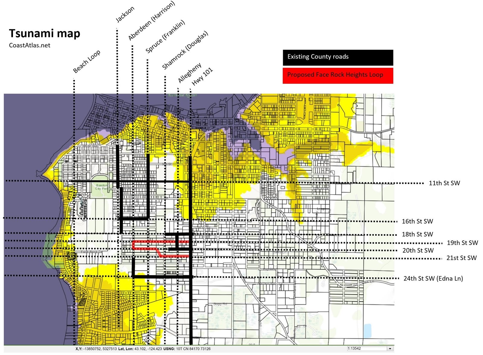
Tsunami map

0 Comments