
Preventing the next big fire
Bandon has experienced a number of major, destructive fires in the past. The community also faces the ongoing threat of tsunamis. These two hazards are exacerbated not only by the prevalence of gorse but by the lack of escape routes from the lower lying coastal areas to higher ground, particularly in the Face Rock Heights area. How can property owners prevent or mitigate these potential hazards?
Thus far, my efforts (concerned property owner) to obtain actual funding or financial assistance of any kind for the clearing, then controlling of our gorse infestation, as well as creating fire breaks for egress have met with no success. Having said that, I must give a “shout-out” to the abundance of expertise and welcome assistance from our largely volunteer, local workforce regarding gorse removal/mitigation and conservation, preservation, and enhancement of wetlands and forests (our beautiful Palustrine system). Absolutely amazing people.
It is apparent, though, that a different approach (than my single voice) is urgently required. We, as Bandon property owners, must band together to approach a multitude of entities: federal, state, county, city, and private and non-profit organizations to apply for actual support (road development, native seed bank, or funding to undertake these activities). Perhaps the voices of 170+ owners (225+ acres), together, will prevail. Clearing the gorse is the “easy” part. . . mitigating and/or preventing regrowth is the goal by protecting and enhancing the existing forested areas and wetlands and establishing new, vigorous native pasture, orchard, and forest. And homesites!
Article summary
ONE: Proposal . . . Face Rock Heights Loop
TWO: Why now? Stepping outside the box, set a trend for the area
THREE: Why this route?
FOUR: Further support (wetland and tsunami routes, elevation grid, topo map, digression into Palustrine System:)
FIVE: Advantages for the City and County include one million in additional property tax revenue attributable to this simple proposal
ADDENDUM: Let’s actively move from what Al Johnson describes as “an impenetrable thicket, community wildfire hazard, and motley collection of stranded assets into a resilient, fire-safe, tsunami-safe neighborhood . . . ” Face Rock Heights is poised to become an incredible cohesive, safe, accommodating, private, country-within-the-city neighborhood.
ONE: Proposal . . . Face Rock Heights Loop
Create a looping, curving, undulating through-road (like Nature)
(The diagram below doesn’t depict the “looping” aspect . . . I’ll get to that later.)

How the loop would address the hazards
- FIRE: Fire break
- FIRE: Egress for fire fighters, emergency personnel
- FIRE and TSUNAMi: Egress for residents of City and County
- ACCESS: Enabling property owners to arrange for gorse removal
Benefits of providing access to the middle of Face Rock Heights with a “loop”
Preserve the character of our area by design: accommodating the trees and wetlands (avoid strict grid)–there is almost always room within the 60′ county road easement to accommodate a roadway. One major exception, possibly no others: there are several stands of trees and wetlands on my property I’d like to preserve, enhance, then maintain (about one-two acres total); other than that . . . we may be able to avoid any other encroachments on private property).
Allow for more tiny “cul-de-sacs” by providing one through-way (30′ wide gravel county-spec road).
Provide access increases property value . . . perhaps $4,000 to $8,000 per 100′ x 100′ parcel.
Put a “face” on Face Rock Heights area . . . looping up and down, in and out of several forests and wetland areas–fantastic hiking/walking territory for residents and visitors alike.
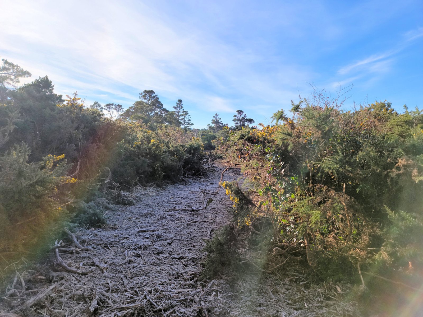
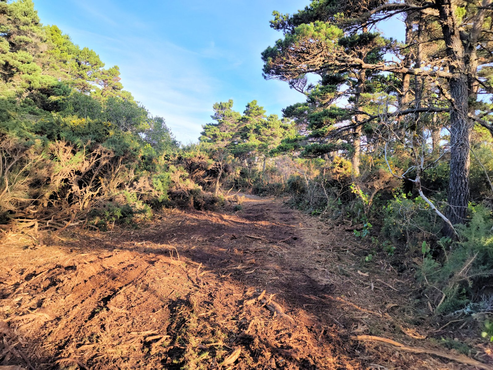
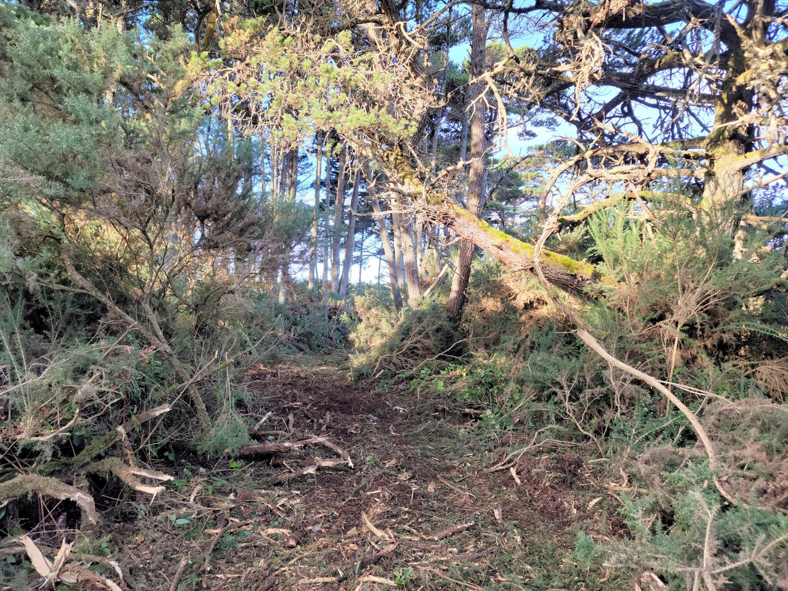
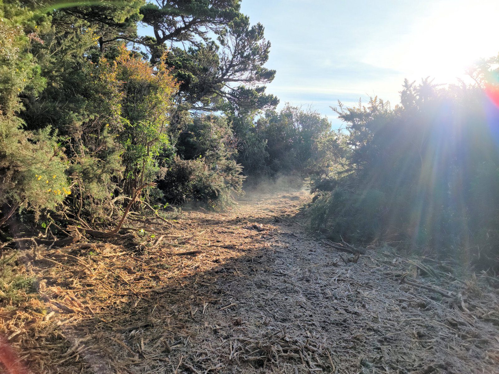
Gallery of photos — system of fire breaks
I’ve mulched throughout the area >>>
- Connected to state parks along Beach Loop
- Alternative for locals and visitors alike to the crowded, narrow Beach Loop walks
- Provide longer hikes and walks (I know we’re not the only ones who love “treks?”) — long loops including Beach Loop
Provide a sense of privacy . . . slightly undulating main loop along with short cul-de-sacs and private drives.


We come from a community that treasured year-round community paths for everyone (hikers, bikers, skiers, snow-shoers) . . . joining trails to create a community-wide system. A community with trails is a connected community. In every way. Locals and visitors, alike.
TWO: Why now?
Peace and quiet . . . country feel, wildlife, wetlands . . . yet, within the bounds of a beautiful coastal town
What better time to “set the tone” for development of the center of Bandon / West side? It is undeveloped as we speak except for a one or two-block area from City of Bandon zoning. Empty canvas.
I’m figuring I’m a typical property owner of this area — limited funds — looking to create a little retirement homestead or sell a few lots (in order to create a little retirement homestead). We treasure our “country feel,” wildlife, wetlands, forests . . . yet we’re in the center of a cool coastal town — Bandon. Possibly another large group includes folks that just want to sell (inherited property?)
Do we want a boring grid? Or . . .
An undulating, curving, flowing through-way into Face Rock Heights / West Bandon? Emulating Beach Loop?
Currently, being an owner in the “donut hole” is quite complicated — it shouldn’t be. Complicated and expensive. No access–so, easy to put on the back burner and ignore the tremendous fire hazard the area presents for the City of Bandon. And, just from my unprofessional perspective . . . why clear the City of Bandon of gorse and have the very heart of the land remain gorse infested? Under just the right circumstances, a fire fueled by this center of gorse will engulf cleared City lands surrounding this tinder box.

Perhaps we should provide initial access to get the ball rolling?
And, while getting the ball rolling, no better time to consider long-term implications of what we create NOW. Boring unnatural grid vs. COVE planning.
I’ll put my money where my mouth is . . . got some wetlands and mini-forests . . . would like to plan accordingly–maintaining them (by deviating off of County road easements onto my property–then back on again.) And, place lots for sale of varying sizes. In hopes many other property owners in the area do the same in keeping with maintaining a natural, inviting neighborhood. Let’s do this.
COVE planning
No two houses look directly into each other’s windows. The name comes from coves of green spaces among the homes which are made possible by winding roads and meandering setbacks.
THREE: Why this route?
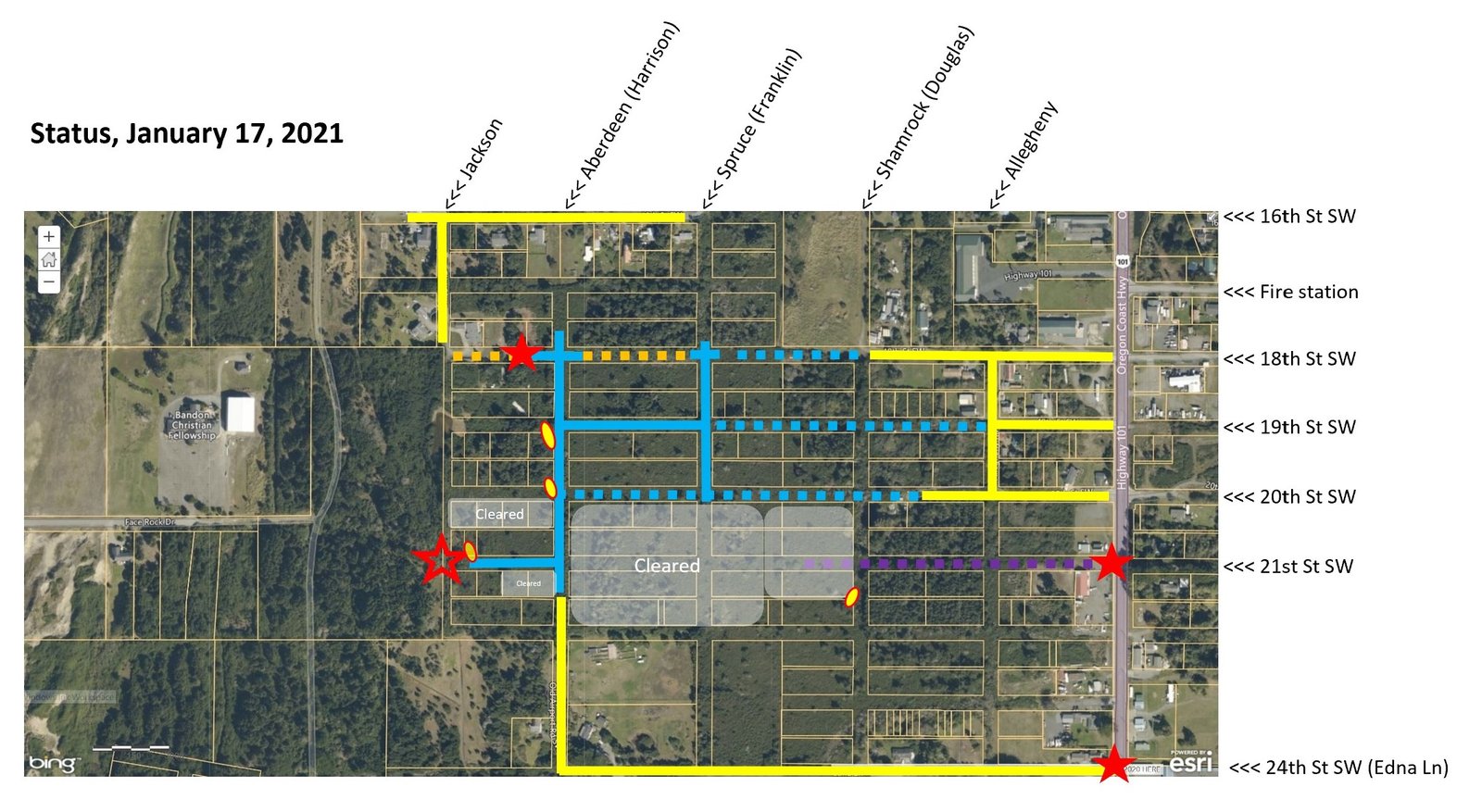
Route description with National Wetlands Inventory and aerial maps:
Beginning at Hwy 101 and 21st St SW heading westward, the loop would pass through a PF01A (water present brief periods during growing season) area; however, there is an historic raised roadway created decades ago which still remains, and we have been able to obtain a permit from Hwy 101 through to just before the loop “jogs” slightly north to avoid a stand of mature pines.
The twists and turns lead the loop carefully through an area criss-crossed with wetlands and small pine forests, though not noted on this NWI wetland map. Upon connecting with the County road easements once again at 20th St SW, the loop heads westward along 20th St SW, then northward onto Aberdeen, then eastward onto 19th St SW.
19th St SW (like Aberdeen) is “high ground” through heavily forested terrain. I believe all the pines can be preserved as there is a 60′ wide easement to work with. If necessary, narrowing the road a bit in places to avoid taking out trees would preserve the the decades-old root systems of the forest. Remove the roots on the slopes . . . create water issues below. Even these relatively minor slopes of a few percent. There are so many reasons to preserve every bit of growth and habitat possible . . . even if that means “slowing down” around a curve or passing through an occasional “one-way-at-a-time” stretch.
Though 19th St SW is the “highest” elevation-wise east-west line through Face Rock Heights, it is only a few feet higher . . . but that few feet creates panoramic views in all directions.
Between Spruce and Allegheny the loop again passes through a PF01A area. Judging from aerial views of this stretch there appears to be no established wetlands down the middle of the easement, and the pond appears to be very avoidable as it lies along southern border of the county easement and private property.


FOUR: Additional support for this route
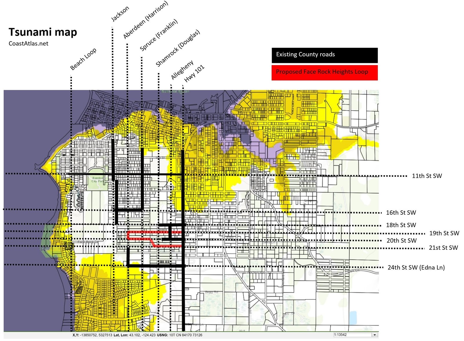
City of Bandon wetlands and Tsunami maps (click to enlarge)
Regarding the deviation northward from 21st St SW before reaching Spruce:
Per the City of Bandon wetlands map there are three PW’s (Possible Wetlands) areas clustered along Spruce (Franklin) between 20th St SW and 22nd St SW. Having now spent the summer selectively clearing the area of gorse and leaving the wetland native vegetation . . . and watching where the year-round and seasonal ponds expand and shrink with the rainy season well underway . . . this area ought to be called DW (Definite Wetland:)
There are also several small groves of trees throughout the area.
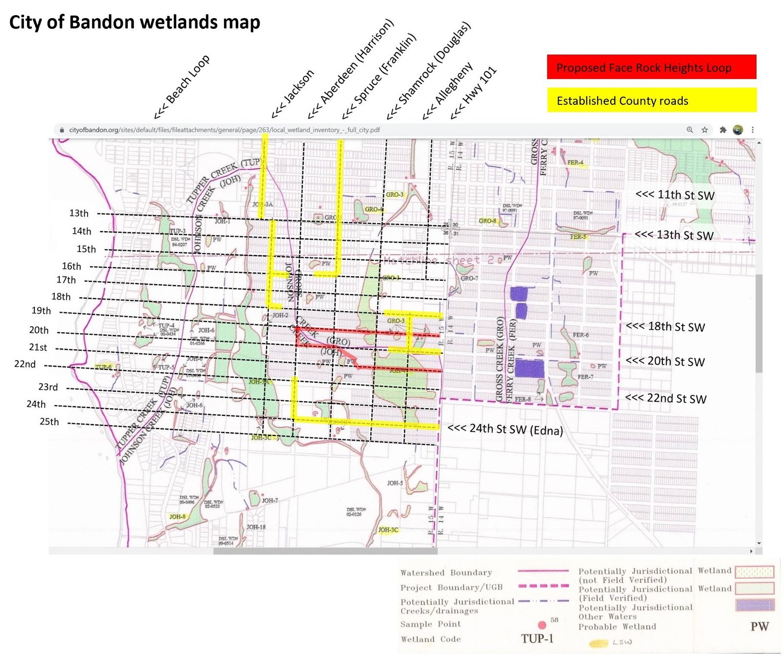
<<< Click on image to enlarge map (and scroll)
The groves plus natural wetlands make a beautiful wildlife refuge that serves the surrounding area as a “sponge,” keeping them dryer than (and “higher”).
Regarding the tsunami map: It appears a north-south (or two) connectors to Face Rock Heights Loop would be very wise. Depending upon owners’ wishes, northward along Spruce (Franklin) may be the most realistic route. I do believe several owners along Jackson (which now ends at 18th) would not welcome additional road development of 18th eastward. However, I believe the owners along Spruce (Franklin) are actually planning to build that road in order to develop their properties. (Need further investigation.)
Elevations, topo map, and Palustrine System
Per the elevations grid the highest north-south and east-west easements through Face Rock Heights central are Aberdeen (Harrison) and 19th St SW, respectively. Not by much, but in our area a foot or two is significant. Makes sense to follow the natural “high” lines for Face Rock Heights Loop, not only for aesthetics but for road-building purposes (beats building through a swamp!)
Deviation from 21st St SW just before Spruce (Franklin): the cause of the pooling and wetlands at and around the intersection of 21st St SW and Spruce (Franklin) is on full display–scroll to the topo map. That intersection is right in the center “of the drain” of a significant drainage system for the west side of Bandon.
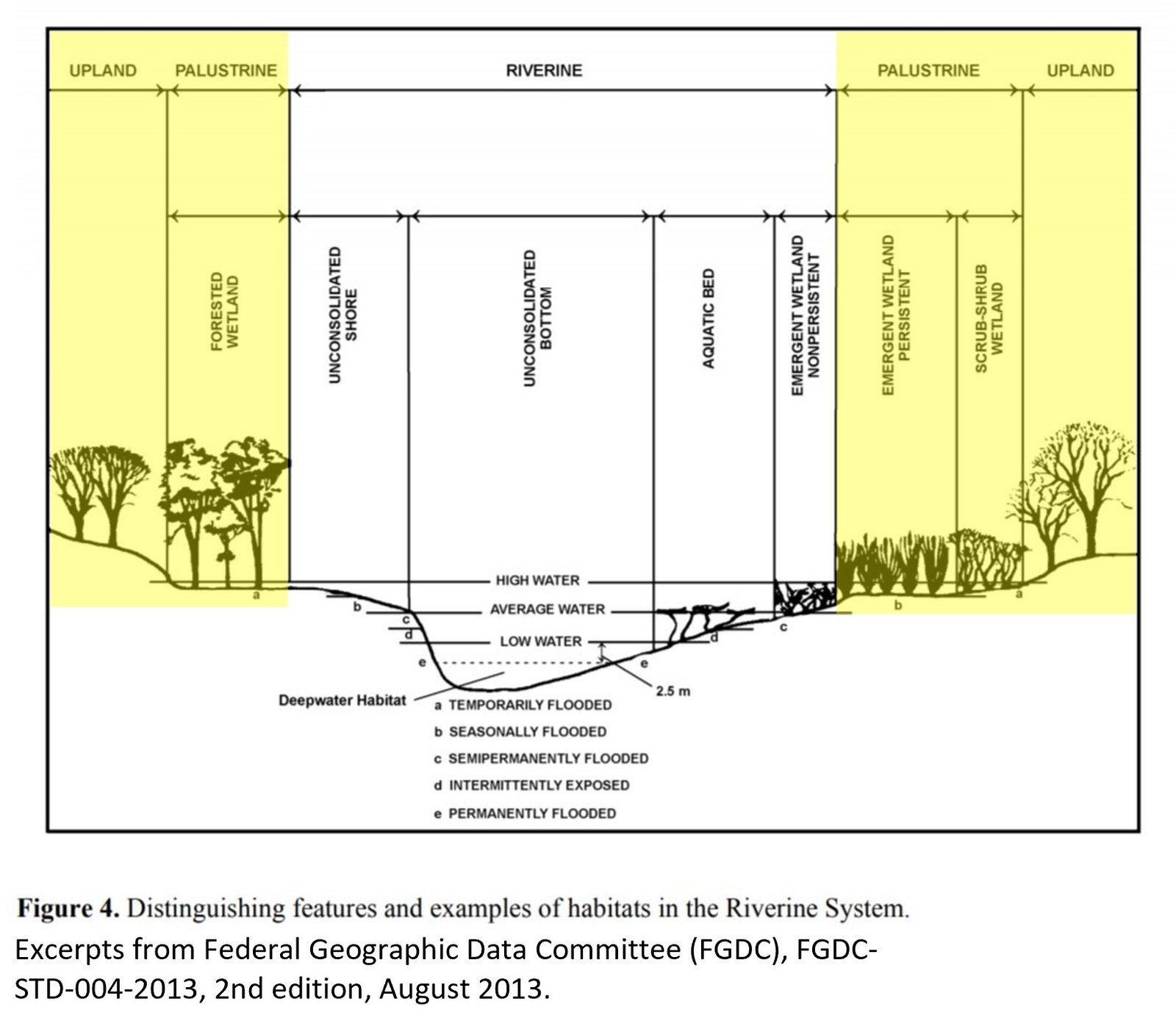
And, finally, given the wide range of classes (scroll to the FGDC figure) our area contains . . . within only 200 acres or so we have everything from aquatic beds through uplands–and that these systems are interspersed throughout (not just one big forest, not just one big emergent wetland)–lends itself to a looping, curving, undulating through-road (like Nature).


FIVE: Advantages for the City and County?
Potential for almost one million in additional property tax revenue per year
Estimated $48,000 per year additional property tax revenue simply by providing access so owners can clear by the time the gorse ordinance is going to be enforced in this area.

ADDENDUM
Memo to Oregon Solutions Donut Hole work group
From Al Johnson
Re: Land Use Context
August 28, 2017
Click to open memo (pdf)
Let’s actively move from what Al Johnson describes as “an impenetrable thicket, community wildfire hazard, and motley collection of stranded assets into a resilient, fire-safe, tsunami-safe neighborhood . . . “
Face Rock Heights can be an incredible cohesive, safe, accommodating, private, country-within-the-city neighborhood. Meandering through-ways so beautiful they draw hikers, joggers, families with strollers and trainer bikes. A quiet alternative to Beach Loop–yet with a plethora of wildlife–and benches along the way.
A rare find, indeed. An asset for both the City of Bandon and Coos County. Not to mention a positive investment for those of us who dared to see–and invest in–the beauty of this Palustrine heaven-on-earth.
Let’s do this.

0 Comments