
Geology
Geology of “central” Face Rock Heights
Soil analyses are from the area between 20th and 22nd St SW on the north and south, and Aberdeen (aka Harrison, Old Airport Rd) and Shamrock (aka Douglas) on the west and east. This area runs the gamut of types, from ponds (wetlands) to forest (loamy, mulch-covered soil). The Soil Texture Triangle and Soil Analysis Report refer to four noticeably different types: P=Pond and F=Forest are obvious; however, both fields (East and West) were gorse-covered for decades, the elevations average 80 and 83 for East and West, respectively.
Soil analyses
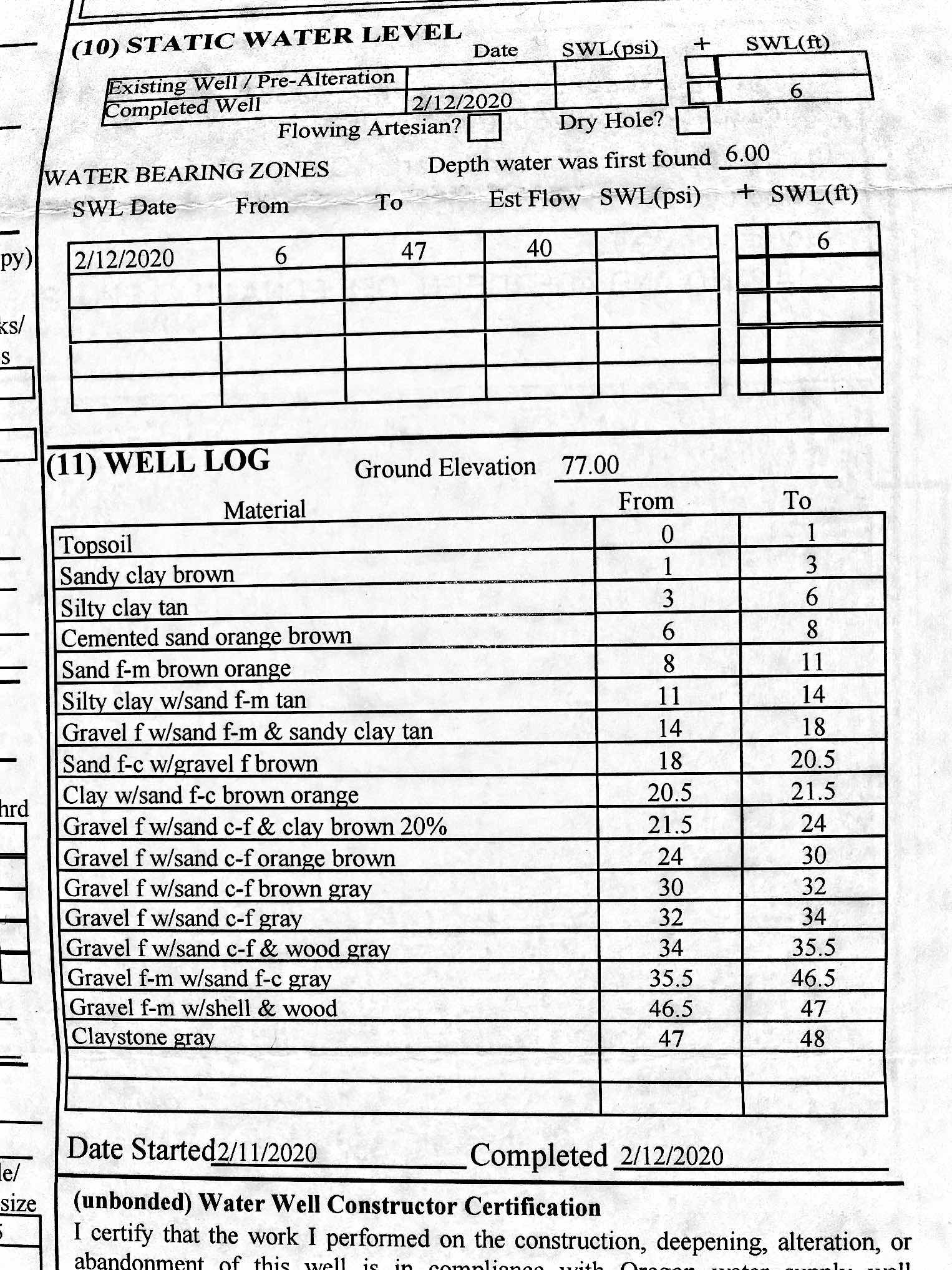
Well Log

Soil Texture Triangle
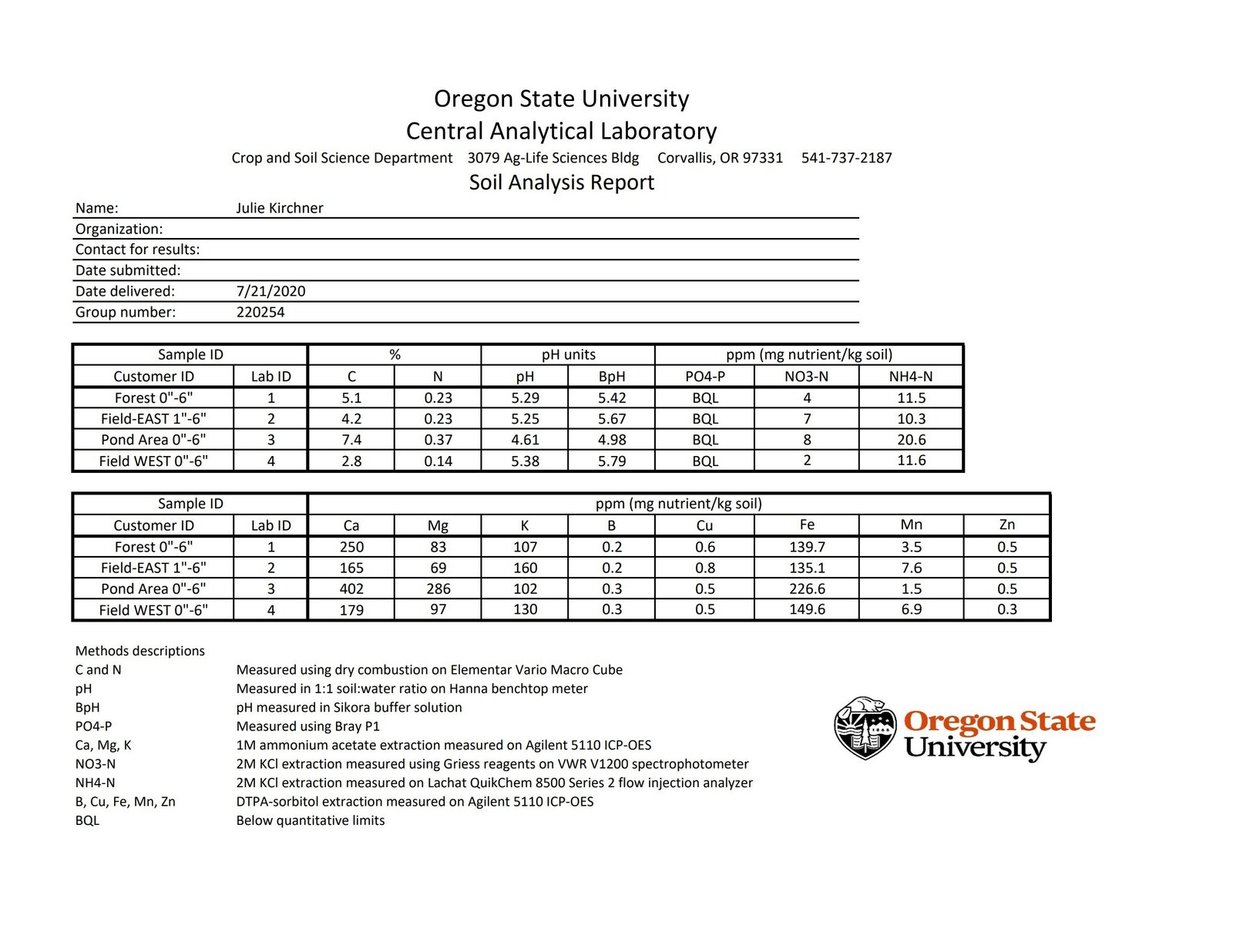
Soil Analysis Report
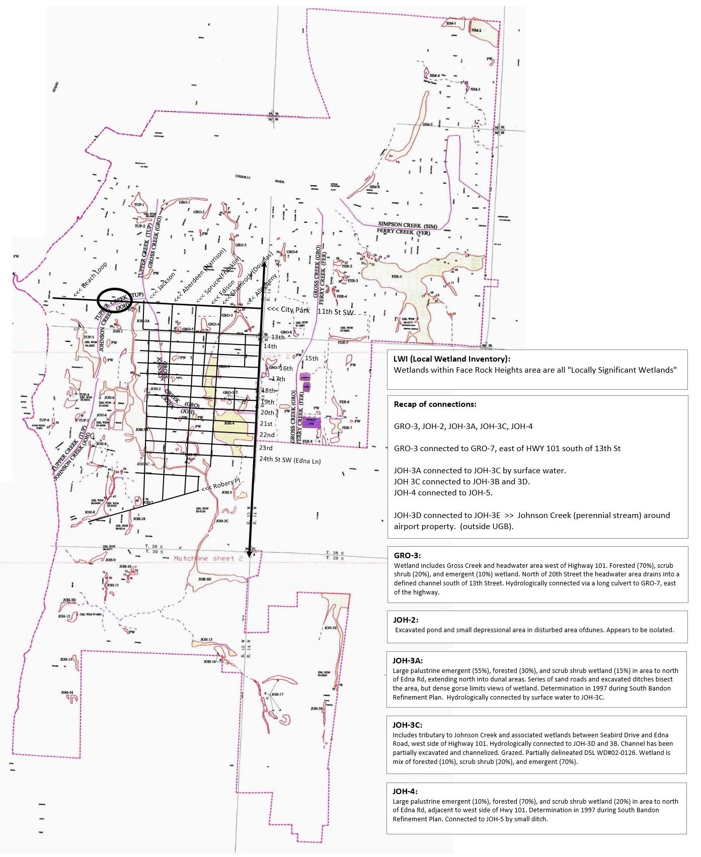
Wetlands, topo, elevations
Topo_Contrast
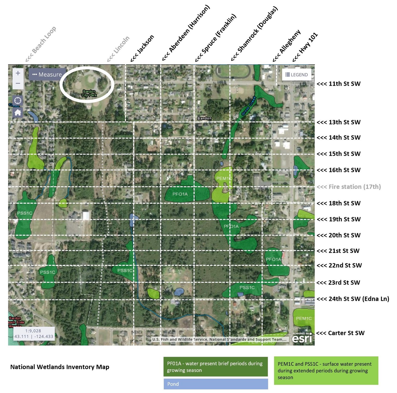
Geo_NWI

Geo_Bandon
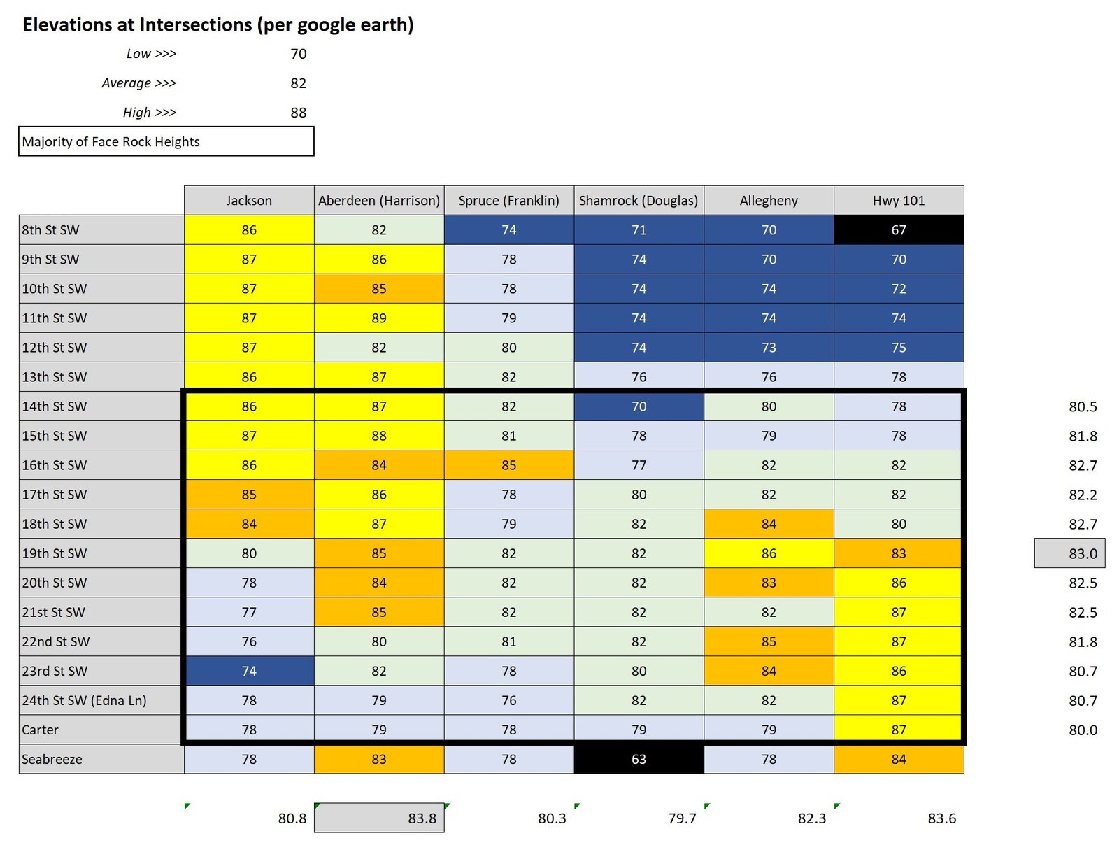
Geo_elevations

0 Comments